Showing posts with label Hilo. Show all posts

Saturday, September 21, 2013

Leaving The Big Island, Heading to Maui

Today is our last day on the Big Island, and concludes the first month of our visit to the Hawaiian Islands. Tomorrow morning we fly to Maui, where we will spend the second, and final, month of our stay. Dan and I enjoyed our time here very much! We visited waterfalls and beach parks, walked through underground lava tubes, and watched the sun set into the clouds on Mauna Kea Mountain. We snorkeled with the beautiful tropical fish, made friends with the neighborhood geckos, and walked through lush botanical gardens. We enjoyed the sounds of local birdsongs, our many trips to the nearby Farmer's Market for fresh tropical fruit, and the aroma of the many blooming plants found all over the Island. Speaking of the Island, we drove (a lot!), and made our way around the perimeter, across the middle over Saddle Road, and to the southern most point of the United States (fittingly named South Point). We saw tons of lava, learned a bunch about volcanoes, saw the molten glow at night from Kilauea, and visited a planetarium. But our home base during our last four weeks has been Hilo, and I thought it only fitting to close out this chapter of our travels with a few "local" photos.


Thursday, September 19, 2013

Kaumana Caves, Hilo, Hawaii

The Kaumana Caves are part of a 25-mile-long lava tube located on Hawaii's Big Island. Set on a hilltop above Hilo, the cave's entrance – actually a skylight formed when part of the lava tube collapsed – is open to curious visitors who want to explore the inside. (A lava tube is a natural tunnel formed by flowing lava which moves beneath the hardened surface of a lava flow. Tubes can be actively draining lava from a volcano during an eruption, or can be extinct, meaning the lava flow has ceased and the rock has cooled and left a long cave-like channel.) 

A concrete staircase leads down into the skylight that forms the entrance to the caves. The section of the caves open to the public stretches for approximately 2 miles. Many areas near the entrance are lit by sunlight, but the cave is damp, cool and often muddy, with lots of vines, ferns and roots hanging down from the entranceway and the ceiling. Visitors can observe a wide variety of lava formations, including some rock that is red because it cooled so fast during the 1881 flow that it retained its color.  

The Kaumana lava tube was formed by lava flow from Hawaii's Mauna Loa in 1881. The eruption of the giant volcano actually occurred on Nov. 5, 1880, but the lava continued its slow approach on Hilo through the first few months of 1881. By late June, it was within 5 miles of the town and began picking up speed. Legend has it that Hawaii's Princess Ruth, sent from Honolulu, is responsible for saving the then-tiny village because she was carried into the hills in late July and took up a position in front of the lava, praying to Pele, the Hawaiian goddess of religion and fire, to spare the town. The flow began slowing, and finally stopped in early August, just 1.5 miles from Hilo Bay.  

Dan and I didn't venture too far into the tube, maybe just 1/4 mile in each direction, but far enough to notice that without our flashlights we would be in absolute darkness. For the serious spelunker, long pants, headlamps, and closed toed shoes are recommended to traverse all of the accessible parts of this cave.


Friday, September 13, 2013

Mauna Kea, Hawaii

Looking out the back windows of our Hilo rental we are able to gaze upon the towering peak of Mauna Kea. On clear days, we can even see the domes of several of the powerful telescopes stationed there. In the Hawaiian spiritual traditions all mountains on the Island are sacred, and Mauna Kea, towering at 13,803 feet above sea level, is considered one of the most sacred. With its high altitude, dry environment, and stable airflow, Mauna Kea's summit is one of the best sites in the world for astronomical observation, and one of the most controversial. Since the creation of an access road in 1964, thirteen telescopes funded by eleven countries have been constructed at the summit. Their construction on a sacred landscape replete with endangered species and ongoing cultural practices, continues to be a topic of debate and protest. Still, many people consider a visit to Mauna Kea a must when visiting the Big Island. The heartiest of visitors who are willing to battle the effects of extremely high elevations have the option of driving, hiking, or traveling with a tour group to the summit, or stopping at 9200 feet at the Onizuka International Astronomy Information Station and Visitors Center. With some of the clearest and darkest night skies anywhere on the planet, the Visitors Center has a nightly stargazing program led by volunteer astronomers using laser pointers to pinpoint and explain the constellations and brightest visible objects in the sky. Telescopes are pointed at various objects in the night sky, including open clusters, globular clusters, double stars, nebulae, planets, galaxies and supernova remnants. Dan and I opted to attend the stargazing program one evening, and timed it so we would be there early enough to watch the stunning into-the-clouds sunset. The temperature at these elevations can get quite cold (it even gets snow at times), as you might have guessed by looking at the pictures below.


Sunday, September 8, 2013

Boiling Pots, Hilo, Hawaii

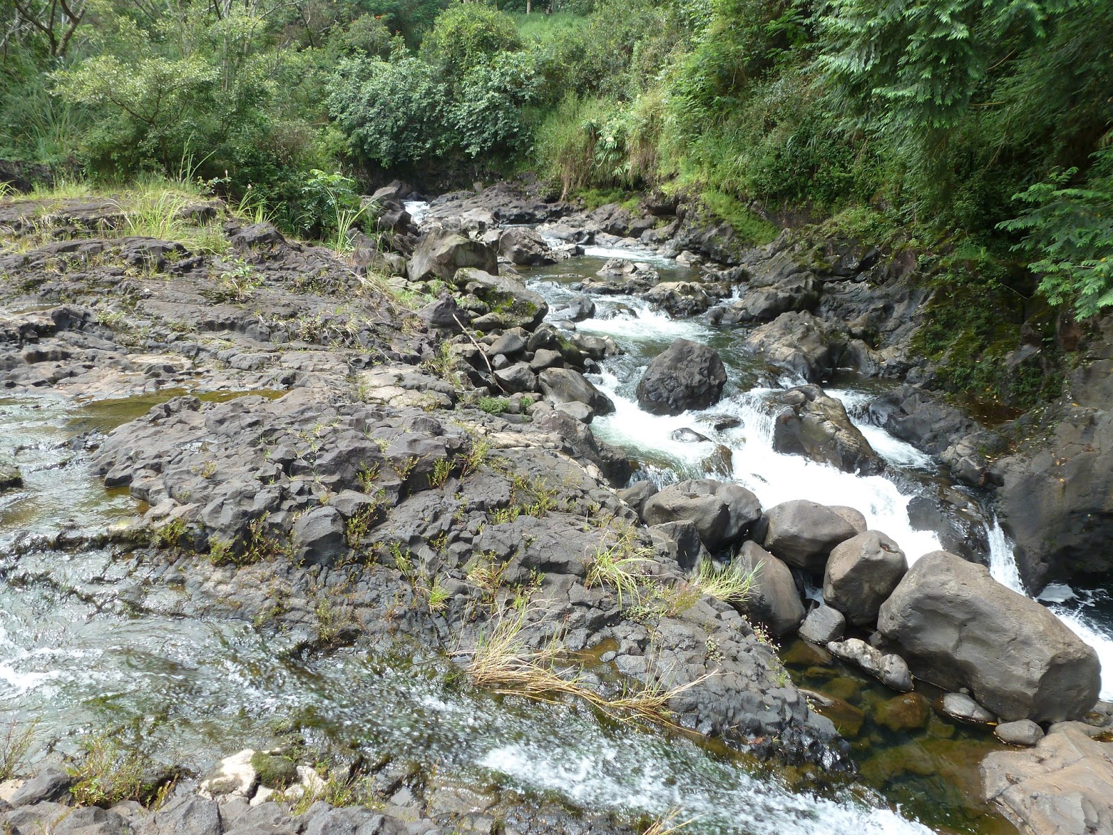
Just up the road from Rainbow Falls is the Boiling Pots, a succession of bubbling pools lined by hexagonal columns of basalt lava and connected by underground flow. During times of heavy rain, the river churns up from beneath a level of old and solidified lava, sometimes quite suddenly, as if the "pots" were boiling over.  Boiling Pots is part of the Wailuku River State Park, and like all state parks in Hawaii, there is no admission fee. The Pe'e Pe'e Falls, a beautiful five-spouted waterfall on the Wailuku River, cascades dramatically into the portion of the river that leads to the Boiling Pots. The "pots" are visible from the parking area, but you can also hike down the trail to the water's edge if you don't mind trekking through rather high grass and steep rocky inclines to get there. Dan took the trail down for a closer look, while I chose to stay in the viewing platform.