Castle Peak Hike
Castle Peak is another favorite hiking
spot for me and Dan whenever we are in the Sacramento area. Located right off Interstate
80 near Donner Summit, it is about a 90-minute drive away, the perfect distance
for a day hike. Timing is important too, because unless you are snowshoeing in
this area (and some do), the winter is out, and at the height of the summer
season, it can be extremely hot. We find late spring, early summer, or autumn the
best time to make this hike. On May 30, just as things were starting to heat up
in the valley, we headed up the hill to see if we could still conquer the
mountain. The trailhead begins at an elevation of 7200 feet. The first two
miles climb 680' to Castle Pass (elevation 7880'), and the last 1.5 miles to
the top of Castle Peak has an elevation gain of 1220', for a final elevation of
around 9100 feet. It's that last 1.5 miles that are the hardest, but so worth
the effort once you make it to the top. The panoramic view from the peaks
provide stunning views of Donner Lake, the surrounding mountains of the Lake
Tahoe area, the Sierra Buttes, and on a clear day, Mt. Lassen. There was still
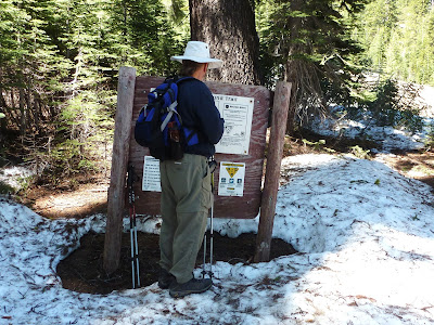
a considerable amount of snow on the ground during our hike, including areas of
the trail we needed to trudge through. At times I wasn’t sure if I was hiking,
or cross-country skiing! But the ambient temperature was very pleasant, the
skies were bright and blue, and the emerging wildflowers were delightful. I am
happy to say we were once again able to make it to the top! Here are some
pictures of our day.


No comments:
Post a Comment